
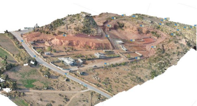
Photogrammetry (Drone data Processing)
-
Duration : 3 months
- Mode : Online/ Physical
- Date : To be announced
Photogrammetry (Drone data Processing)
With the Drone data processing feature, you can easily add geotags to the drone images’ EXIF data and process them later in the photogrammetry software. To perform geotagging, you need raw data logs from the base and the rover, or a ready POS file with the events, and drone images. The process includes two steps: processing and geotagging.
Course Outcomes
ØBasic Concept of UAV Based survey.
ØTo build the skills to handle and process UAVs & GNSS data.
ØStudents get able to build Digital Topographical Map with Orthomoasic and Digital Elevation model.
ØBasic knowledge of Surveying Software and its working.